ATAK for Public Safety, Without the Plugin Pile
Search and rescue teams, police departments, and emergency managers want aircraft, drones, sensor detections, and weather on the ATAK devices their people already carry, without becoming full-time plugin administrators.
How it's done today
ATAK can show almost anything, because the ecosystem has a plugin for almost everything. Getting a working picture means assembling and maintaining a stack like this one.
A TAK Server
The official TAK Server or an open-source alternative, with certificates, users, groups, and federation to neighboring agencies.
One plugin per data source
Separate plugins for ADS-B feeds, AIS, weather and METARs, radar vendors, mesh radios, video, and drone control. Each has its own settings and its own release schedule.
Data packages and imagery
Configuration, map tiles, overlays, and mission data bundled into data packages and pushed to devices, then rebuilt whenever something changes.
Device-by-device upkeep
Every phone, tablet, and laptop needs the right ATAK, iTAK, or WinTAK build with the right plugin versions installed and configured.
Where it breaks
Plugins are version-locked. Each plugin is built against a specific ATAK release. Update ATAK and some plugins stop loading until someone rebuilds, re-signs, and redistributes them.
Nobody owns it full time. Most volunteer SAR teams and small departments don't have a dedicated TAK administrator. The setup works until the one person who built it is on leave.
Layers, not a picture. Each plugin draws its own layer. A drone seen by radar, a Remote ID receiver, and a camera shows up as three icons, and the person on the ground has to work out that they're the same aircraft.
Everything goes to everyone. Most feeds push all of their data to the server. High-volume sources can overwhelm a small TAK Server, and mutual aid partners see more than they need, or less.
No record of what was shared. When an incident review asks who saw what and when, there's no single log of what was sent to the field.
With Empyrean
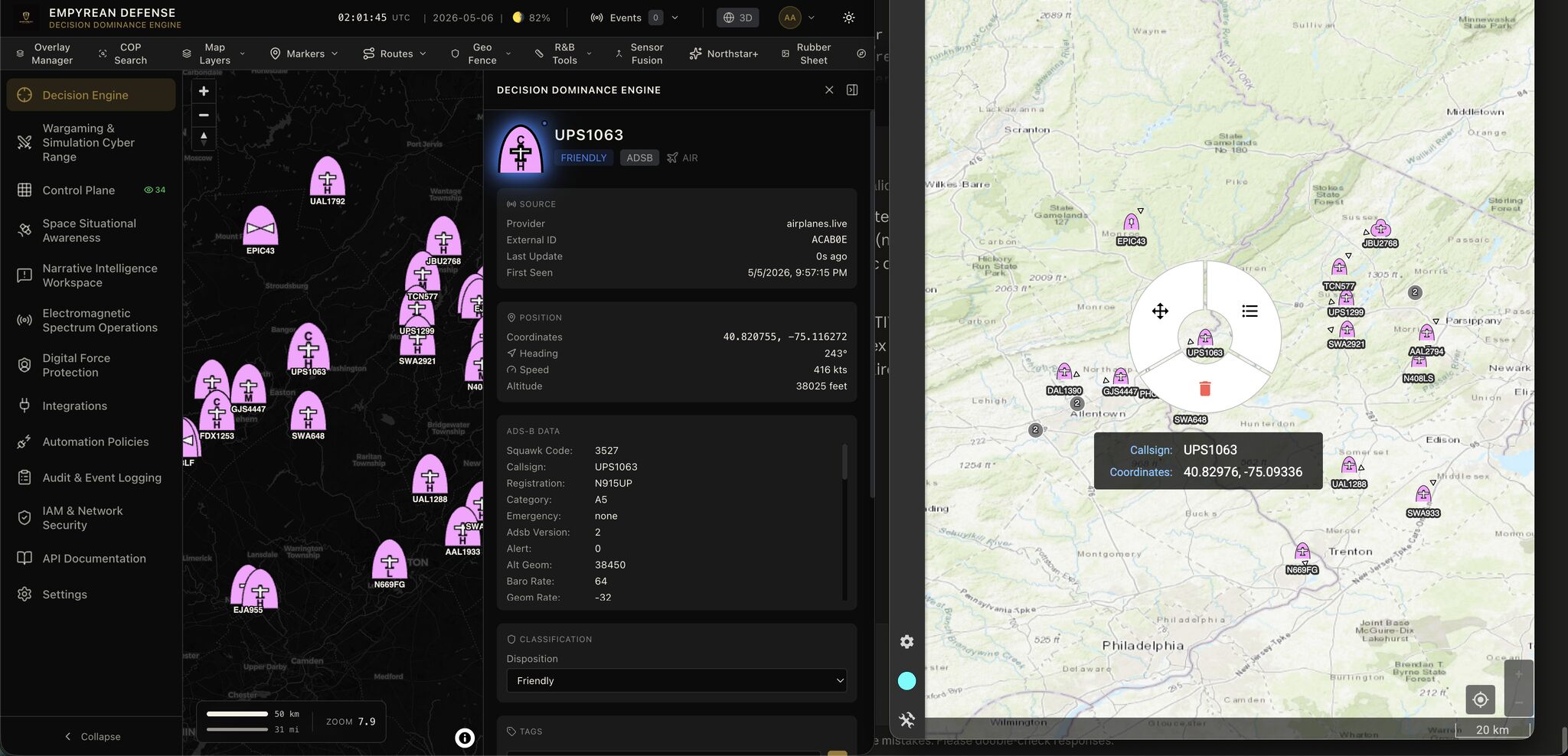
Empyrean sits upstream of your TAK Server. Sensors and data sources connect to Empyrean once; it fuses them and sends one clean set of tracks to TAK as standard Cursor on Target. Your devices keep doing what they already do.
One feed instead of a plugin per source
Aircraft, drones, Remote ID, radar, cameras, AIS, and weather arrive as standard CoT tracks. Devices need no per-source plugins to see them, so ATAK updates stop breaking your picture.
Fused tracks, not duplicate icons
The same drone seen by three sensors becomes one track with its identity and the sensors that confirmed it, rendered with MIL-STD-2525 symbology.
Each agency gets only its share
Connect several TAK Servers, such as your own, the sheriff's office, and a state EOC, and filter what each receives by domain and track type. Filtering also keeps volume within what each server can handle.
Alerts that land in ATAK
Policies can drop markers or send GeoChat alerts when conditions are met: a drone entering a TFR, a geofence breach, a weather threshold, or a device co-traveling with a team.
Works where your teams work
TLS and client certificates to your servers, and edge or air-gapped deployment for incidents without reliable internet. Local drone detection keeps working when the backhaul doesn't.
An audit trail
What was sent, to which server, and why is logged, which matters for after-action reviews and records requests.
In practice
A county SAR team runs a TAK Server for its members and federates with the sheriff's office. During a search, the incident commander wants three things on every searcher's device: the team's own positions, any aircraft or drones over the search area, and the weather.
Today that means an ADS-B plugin, a Remote ID solution, a weather plugin, and a data package for the search-area imagery, each installed and kept current on every device. With Empyrean in front of the TAK Server, the aircraft, drones, and weather arrive as tracks and alerts the devices already understand. The sheriff's server receives only the drone and aircraft tracks it asked for. When a drone crosses into the temporary flight restriction over the search area, a GeoChat alert reaches the incident commander's device.
What you still need
- You still run a TAK Server. Your devices receive Empyrean's tracks from it, along with your existing users, groups, and federation.
- Sensors are yours. Empyrean connects to the radars, Remote ID receivers, cameras, and feeds you choose; it doesn't replace them.
- Plugins that control hardware on the device, such as a drone controller or a radio, are still plugins. Empyrean removes the plugins you were only using to move data.
Built on
Further reading
Frequently asked questions
Do we have to replace our TAK Server?
No. Empyrean sends tracks to your existing TAK Server as Cursor on Target, and your devices pick them up from there. Your users, groups, certificates, and federation stay as they are.
Do our devices need an Empyrean plugin?
No. Tracks arrive as standard CoT, which ATAK, iTAK, and WinTAK all display without extra plugins.
Can different agencies see different data?
Yes. You can connect multiple TAK Servers and choose, per server, which domains and track types it receives, for example only drone and aircraft tracks for a mutual aid partner.
Will this overwhelm a small TAK Server?
Per-server filters let you send only what each server needs. Empyrean can ingest far more than a typical TAK Server is sized for, so filtering is also how you keep the server healthy.
Does it work without internet?
Yes. Empyrean runs at the edge or air-gapped. Locally connected sensors, such as LAN-connected Remote ID receivers and radars, keep feeding the picture when the internet connection drops; cloud-only sources resume when it returns.
Read next

See your sensors on your ATAK devices
Tell us which TAK Server and which data sources you run today, and we'll show you what one fused feed looks like.