Weather- and Wildfire-Aware Operations
Emergency managers, utilities, and operations centers need to know not just what the weather is, but what it means: where a fire is heading, who is in its path, and which sensors and links it is degrading.
How it's done today
The data is public and good. The problem is that it lives in a dozen places, and turning it into a decision is left to the people on shift.
Weather sites and apps
NWS forecasts, METAR and TAF observations, and radar loops, each checked separately.
Fire maps
Satellite hotspot maps and wildfire perimeter maps, usually in a browser tab next to the operational map.
Fire behavior tools
Specialist models that need trained analysts, fuel data, and terrain to run, and aren't connected to live operations.
Space weather dashboards
Geomagnetic storm and solar activity indicators that rarely reach the people whose GPS, HF, or satellite links they affect.
Where it breaks
Data, not consequences. A hotspot dot doesn't say where the fire is going, and a rain forecast doesn't say how far your radar can now see.
Mental cross-referencing. Operators combine weather, fire, population, and asset locations in their heads, which fails when they're tracking dozens of things at once.
Clear-sky assumptions. Sensor coverage and radio range are briefed for good weather and quietly shrink when conditions change.
No triggers. Nothing raises an alert when a fire's projected path reaches a protected area or a storm crosses a threshold; someone has to notice.
With Empyrean
Empyrean brings the environmental feeds into the same picture as your operations and computes what they mean for your people, assets, and sensors.
Predicted fire spread
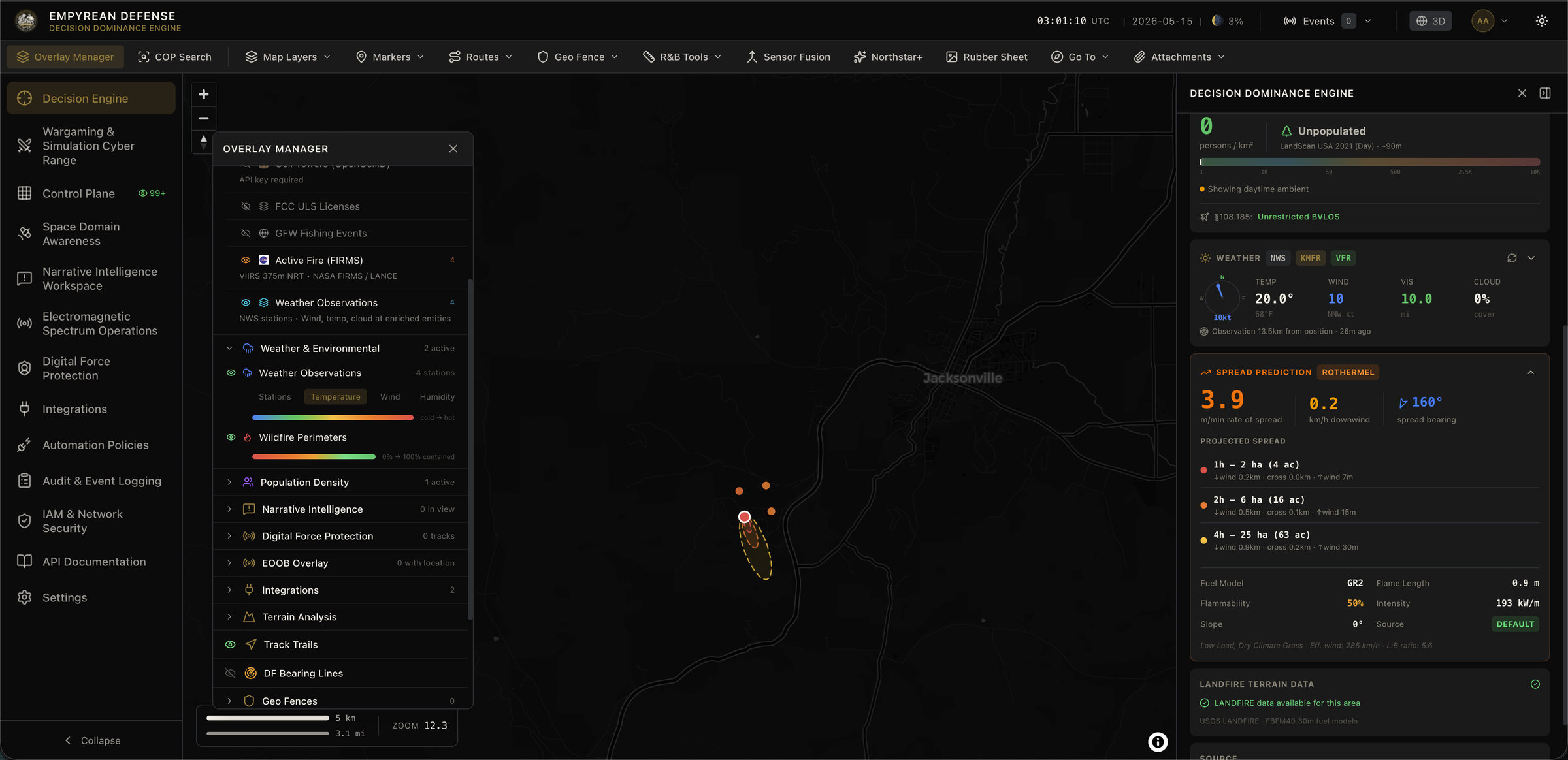
High-intensity satellite fire detections automatically trigger a Rothermel spread prediction using fuel models, terrain, and live wind, producing 1-, 2-, and 4-hour spread areas on the map.
Exposure and protected areas
Projected spread is checked against population density, your geofences, and known fire perimeters, so new ignitions and threatened areas stand out.
Weather on every track
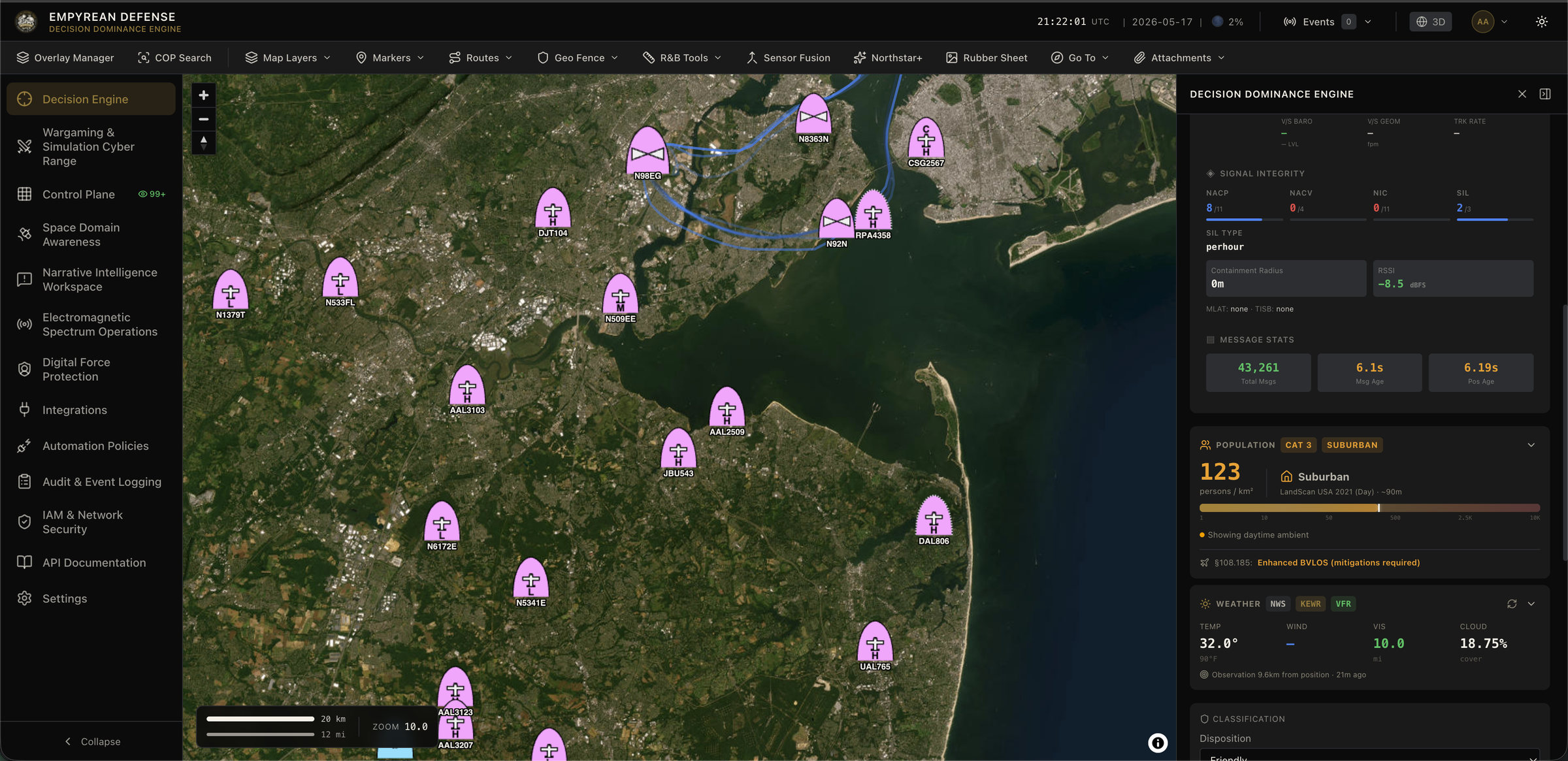
Each track shows the conditions, population density, and nearby fire activity at its own location, without opening another tab.
Weather-aware sensors and links
Detection confidence and radio coverage are adjusted for current conditions, so a rain-degraded radar or a shrinking link is visible before it causes a miss.
Space weather that matters
Geomagnetic storm levels feed satellite pass predictions and GPS and HF degradation indicators, and can trigger alerts.
Alerts and sharing
Policies raise alerts on fire proximity, weather thresholds, or space weather levels, and can send them to field teams on ATAK.
In practice
A satellite pass detects a new, high-intensity hotspot 12 km upwind of a utility substation on a dry, windy afternoon. Empyrean flags it as a new ignition because it's outside any known fire perimeter, runs a spread prediction with the current wind, and draws the projected 2-hour spread reaching the substation's geofence. The utility's operations center gets an alert with the projection, the population in the path, and the nearest crews, instead of discovering the fire from a news report.
What you still need
- Qualified people for official decisions. Spread predictions support incident commanders and fire behavior analysts; they don't replace official forecasts or analysis.
- Internet access for most feeds. Data is cached so the picture stays usable offline, with staleness clearly marked, but updates need a connection.
Built on
Further reading
Frequently asked questions
Where does the fire data come from?
NASA FIRMS satellite detections, NIFC wildfire perimeters, LANDFIRE fuel models, ESA WorldCover land cover, and terrain elevation, combined with live weather from NWS, METAR, and nearby weather stations.
How is fire spread predicted?
When a satellite detection exceeds an intensity threshold, Empyrean runs a Rothermel surface fire spread model using the local fuel model, slope, and current wind and humidity, and draws the projected spread for the next 1, 2, and 4 hours.
Does weather change how sensors are scored?
Yes. Detection confidence and RF coverage are adjusted for current conditions such as rain, so operators can see when a track's confidence is lower because of the weather.
Is this a replacement for an incident meteorologist or fire behavior analyst?
No. It's decision support that puts the data and model output in front of the people making operational decisions. Official forecasts and fire behavior analysis remain with qualified specialists.
Read next

See weather and fire in your operational picture
Tell us your area of responsibility and the assets you protect, and we'll show you what the environment means for them.